
After my race, all of us spent a week in Switzerland and then another week in London. Anika and her friend Matthew had more vacation time than us working adults and so had time to visit me in Ireland. They explored Dublin and its surroundings on their own while I had to go back to work, but last weekend I had three days off, rented a car, and we went to a few places further away from Dublin.
I'll post pictures from our vacation soon. In the meantime have a look at the ones I took on our mini vacation here in Ireland. I posted them on picasa.
Even though Ireland is small, it is not possible to see it all in a few days. We selected the Burren, the Dingle peninsula, and the ring of Kerry as our destinations for that weekend.
The weather, always unpredictable and changing, wasn't great and I hope to go back to some of these sites and take pictures in sunlight. We had quite a bit of rain, but also a lucky few moments when we didn't have to use our umbrellas to take in a view or hide in a visitor center.
 |
| Living just below the clouds. At sea level! |
 |
| Sometimes bad weather can make for good photo opportunities. |
The Clifs of Moher are a world-famous attraction but were a little underwhelming in the weather we saw them. In proper sunset light, like on the postcards, or from a boat, these tall walls look much more impressive. We need to go back and have another look.
 |
| The Cliffs of Moher |

On day two we drove around the Dingle peninsula. The sights were fantastic, but mostly rained out. On the other hand, we learned a lot about the history of this area. Stone ring forts and beehive dwellings from prehistoric times show that people have lived here for thousands of years. The writings from more recent inhabitants show that life here was difficult at times.
Peig Sawers married a farmer on Blasket Island and later told her life story in a Gaelic autobiography. The success of the book ignited a small literary movement and encouraged other inhabitants to write about their struggles and experiences.
This area is close to the western-most point of Europe. The next county to the west is the USA. A lot of the stories written on Blasket Island tell of hardship and famine, and friends and family who have left to settle in the USA. Some of them never heard of again, others in regular contact sending news of hope and loan money for a ship passage to the USA. In the 1950's the Blasket Islands were evacuated. The dwindling number of inhabitants and supply of peat (turf), their heat energy supply, made continued inhabitation too difficult. Today, tourists roam the ruins left behind.

 |
| Peig Sayers is buried on the mainland, overlooking the Blasket Islands. |
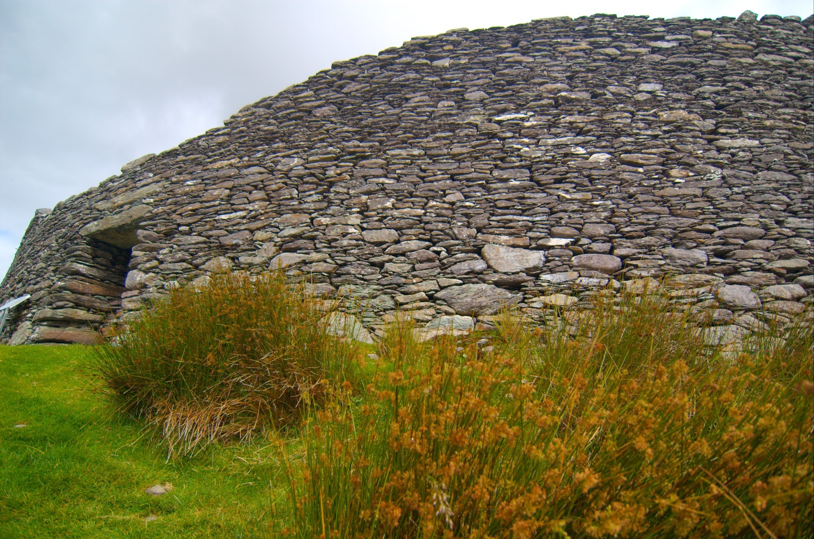
An impressive sight are the store ring forts built between 1,700 and 1,500 years ago. Mostly the outer walls remain, and the small entrance gives an indication that defense was an important part of daily life back then.

Another aspect that intrigues me is how religion has shaped the lives of people and is reflected here in monuments, buildings, and the history of this land. It is not uncommon to see a place here that was holy to a group of long-forgotten people, and then find that when Christians arrived, they would build churches on the same sites, putting graveyards on top of older ones, mixing pre-christian symbols with crucifixes. What made the Christians believe that a site for worshiping Norse or Celtic gods was also a site favored by their god?
 |
| An ogham stone near Kilmalkedar where the Normans later built this Romanesque church. |
The cross in the picture below has been placed many hundred years ago and suffered the same fate as the ogham stone: Most of it is underground now.
 |
| The ground has risen, covering the base of that cross. |
 |
| Skellig Michael and Little Skellig. |
 |
| A mural in the visitor center for Blasket Island. |
Hi Rolf. Did you see the "Ogham" stone in the British Museum? It was in the huge covered lobby area where round library is. I stared at the lines carved in side and wondered two things. How expressive could such a crude alphabet be? And how annoyed were the Irish that this treasure was in the British Museum?
ReplyDeleteNo, I did not see it. Another reason to go back ;-)
ReplyDeleteThe alphabet is pretty basic, but we all know that 0 and 1 is enough to express anything we are capable of expressing. It depends on the language.
Wikipedia has a nice article. It seems they used Primitive Irish and something called Pictish for language. Most of the writing that survives is on grave monuments and says things like "son of
" or "member of tribe". More elaborate stuff may have been written on wood or other material that has rotted away by now.
I don't know how the Irish feel about their artifacts. Many of them are still in their original locations and you can go and touch them.
Hi Rolf,
ReplyDeleteThe pictures and the description are just great. Keep it up. Cheers,
Neil